Maps
Understanding the 1930s drought on the Canadian prairies means focusing on the consequences of the overlap between three geopolitical entities (the provinces of Alberta, Saskatchewan, and Manitoba) and an ecological region (the North American great plains). As evidenced in the below map, the overlap is partial at best, with the vast extent of the North American great plains reaching far south of Canada’s international boundary with the United States.
The North American Great Plains

It wasn’t just the driest areas of the prairie provinces (the mixed grass and shortgrass prairie regions) that were changed by drought. Portions of the aspen parkland and forest regions, arching around the northern extent of the North American great plains, were dramatically transformed as climate refugees arrived in search of more hospitable landscapes.
The Prairie and the Parkland

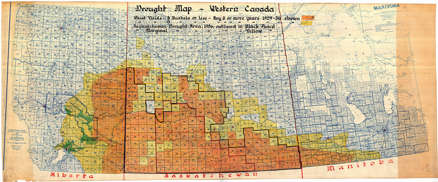
The checkerboard pattern of prairie settlement, laid out without regard to prior Aboriginal and Metis geographies or to the region’s underlying environmental logic, remains one of the iconic images of the Canadian prairies. The below map offers a haunting remaking of this imagery, as devastatingly-low wheat yields marked in bright slashes of orange and yellow document the over-reaching ambition of prairie settlement.
Drought Map - Western Canada